
Last night we finally arrived at our destination (See where we are) while the sun sank into the Indian Ocean!

- Map the sea floor.
- Examine the habitats and creatures that live there.
- Measure how much light is in the water, how hot it is, and how salty it is.
- Measure how much the water level changes with the tides.
In today’s blog, I’ll explain a bit about how we map the sea floor.
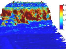
You may think that the sea floor is flat, but it can have seamounts (underwater mountains) and canyons and everything in between, just like dry land (see example below).
In the past, ships dropped long ropes with heavy weights on them to measure the distance from the surface to the sea floor.
Today we use sound waves to measure this distance – it is much more cost effective. This is called sonar (watch a video of how it works).
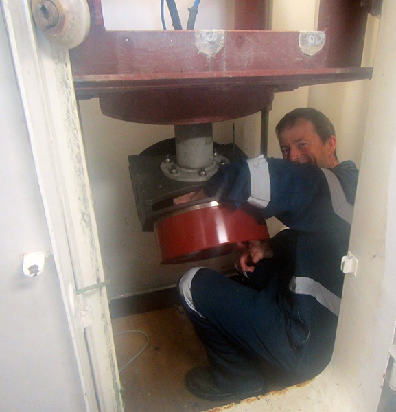
We attach a high-tech instrument (a multi-beam sonar) underneath the ship (see below).
It sends sound pulses downward. The time it takes for the sounds to hit the bottom and bounce back to the ship tells us how deep the sea floor is and whether it is made of sand, rock or mud (see picture below).


And here is a map of the route the ship will take (blue lines) through the study area to map the sea floor with sonar. Where possible, we run sonar at night to free up the days for other work.

See you then!
